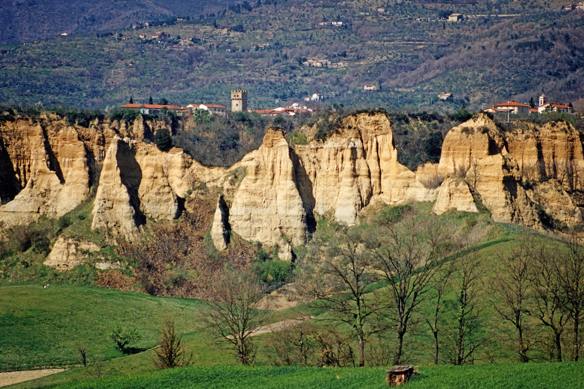
Le Balze di Castelfranco: the Valdarno from prehistory to the Renaissance and the landscapes of Leonardo da Vinci
CAI path 51. Ring route of the sulphine water and the ditches.
Visit of Castelfranco and the Pieve di Soffena, frescoed by Florentine and local artists including "lo Scheggia" Masaccio's younger brother.
For food and wine stop at the Fattoria di Certignano.
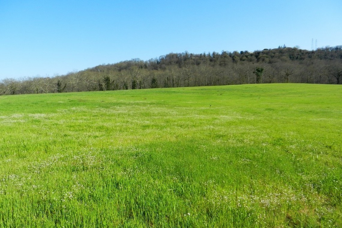
Piantravigne: medieval village and breathtaking view of the Balze.
Paleontological Museum of Montevarchi.
NATURAL RESERVES OF THE VALLEY OF HELL AND BANDELLA, PONTE A BURIANO AND PENNA. THE KINGDOM OF WATER UNDER THE BRIDGES OF ACQUA BORRA, ROMITO 2
Fauna: herons, moorhens, kingfishers, mallards, ducks, migratory birds resting in the nature reserve.
Flora: There is a botanical garden in Bandella where are kept the main botanical species of the Reserve, a Green Hall in Castiglioncello and sighting huts; the access to these structures is allowed only with guided tours.
The Monumental arboretum of Moncioni, nineteenth-century collection of conifers from all over the world and some sequoias, refuge for squirrels, dormice and various species of birds.
The area is located in the village of Moncioni, in the Municipal district of Montevarchi, on the Valdarno slopes of the Chianti Mountains, at a variable altitude between 540 and 568 m a.s.l. The protected area was established to preserve and enhance the "Pinetum di Moncioni", an important nineteenth-century collection of exotic and non-exotic conifers, located in the garden of a private property (Villa Gaeta). A monumental arboretum of great historical interest has therefore been built over time.
http://www.parks.it/z.arboreto.moncioni/
Trail A
Trail A: Service Center (Monticello) - lookout huts - Pian di Chena
Length: 2300 meters
Walking time: 0:45 h (in addition to the time to stop at the huts)
Difficulty: easy
Along the ridge near the Service Center you can admire the hills of the Valdarno, the Pratomagno massif and the Arno valley; in correspondence with the Ansa di Bandella it is possible to observe the wetland as a whole from the homonymous bridge; coming from the Service Centre, after crossing the bridge, with a small detour of about a hundred metres, both on the left and on the right, you can access the structures for sighting birds; from the huts you can continue along route B.
Trail B
Trail B: Service Center - lookout huts - Ascione stream - Service Center
Length: 4000 meters
Journey time: 1:15 h (in addition to the time to stop at the huts)
Difficulty: medium\easy
It represents the most complete route to observe the great variety of environments present in the Reserve. Using Trail A up to the observation huts, it is possible to continue advancing through woods and meadows until you reach the panoramic point near an artificial lake; from here you can admire the various environments present in the area and in particular the Ansa di Bandella; continuing you cross the Ascione stream and go up towards the Service Center thus completing a particularly suggestive and panoramic itinerary.
Trail C
Trail C: Pian di Chena - Agna stream - lookout huts
Length: 2000 meters
Walking time: 0:45 h (in addition to the time to stop at the huts)
Difficulty: medium\easy
It is the route that allows you to discover the woods of the Reserve, crossing dense oak groves you arrive near the Agna stream at the confluence point with the Arno, from which you continue up to the panoramic observation point which allows you to observe the steep slopes engraved from the Arno rich in vegetation; through the path that runs alongside the cultivated fields you reach itinerary A and continue towards the huts and then return along the main road up to Pian di Chena.
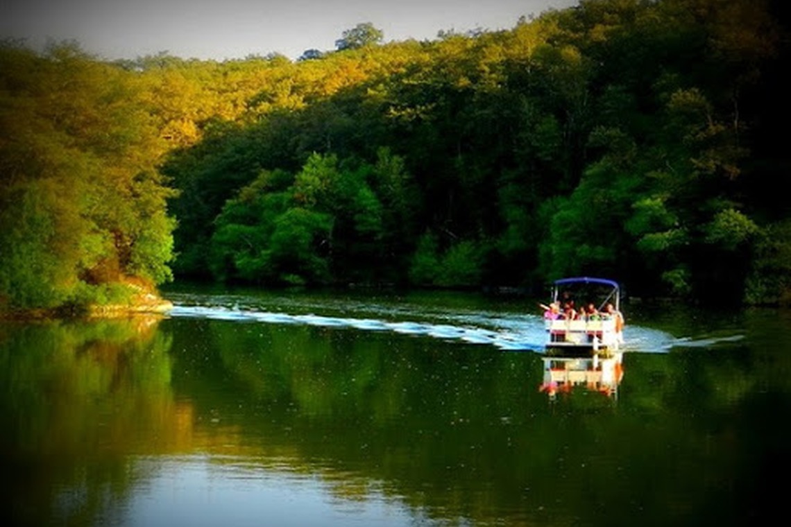
Arno Ecological Preserve
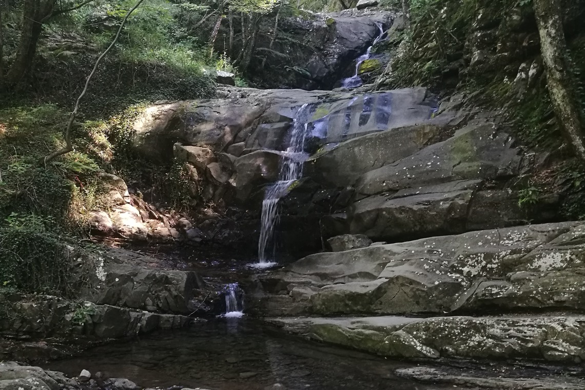
Suggestive route through woods and waterfalls (Acqua borra, Bandella, Ponte Romito, ancient fortified settlements of Rondine and Penna, Ponte a Buriano)
Length: 7km and 800m
Journey time: 3 hours
Difficulty:
In the locality of "Acqua Borra", at the western end of the Reserve, the path of the Great Excursion of the Arno starts or ends, depending on the direction of travel, which, touching Bandella and Ponte Romito, continues up to the Reserve Natural of Ponte Buriano and Penna. The GERDA crosses all the points and environments of greatest interest on this side of the river and lake, also crossing spectacular places such as the steepest walls carved by the waters over the millennia.
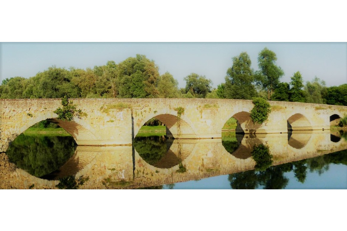
Ponte Buriano
Typology: Provincial Nature Reserve
Area: 668 hectares
Environments: humid area
Municipal discrits: Arezzo, Laterina and Civitella in Valdichiana
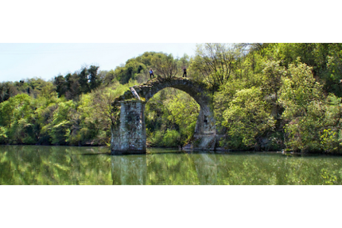
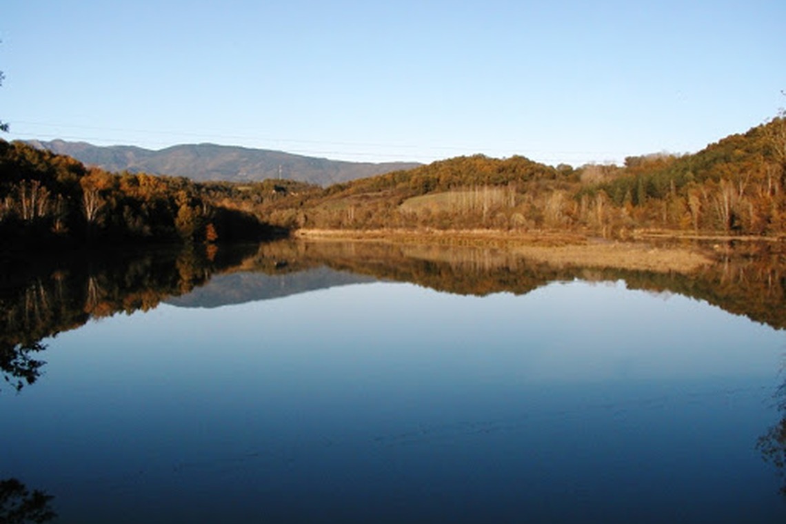
Description: The Ponte Buriano and Penna Reserve is among the first protected areas to have been established by the Province of Arezzo, with the aim of protecting the numerous species of birds that choose these stretches of the Arno for nesting, stopping during migrations and wintering. It includes a stretch of the Arno of about 7 km, from Ponte Buriano, where the river receives the Canale Maestro della Chiana coming from the Sienese Valdichiana, to the ENEL dam of Penna, which completed in 1958, caused the flooding of a good part of the valley, forming a reservoir of about 10 million cubic metres. The dam made its effects felt up to Ponte Buriano, at the eastern end of the Reserve, where in the flat section preceding the "Stretto dell'Imbuto" the expansion of the waters had as a result the expansion of the marshy area surrounding the Canale Maestro, today covered by a vast cane thicket. Here you can still see the remains of the Mulino dell'Imbuto, built by the monks of the Badia di S. Trinità dell'Alpi taking advantage of the particular morphology of the valley. The mill is just one of the many signs left by man in this stretch of the Arno, a very important crossing point since Roman times which remained so throughout the Middle Ages, the period in which the Buriano bridge was built. Along the Arno, the ancient fortified nucleuses of Penna, Rondine and Monte Sopra Rondine are worth a visit, whose position, chosen in the past for strategic reasons, now offers beautiful views of the river and the wetland. A Contiguous Area was created around the Reserve, to protect the wetland and to expand the area for the protection of the fauna and in particular of the avifauna, a strip of territory with specific regulations, with the function of "buffer" between the delicate river environment and the surrounding agricultural and urban areas.
Culinary stop at the Valle dell'Inferno restaurant (5 stars, meat or fish menu over 70 Euros per person).
http://www.comune.loro-ciuffenna.ar.it/
CAI trails 33 – 35 – 37 – 21
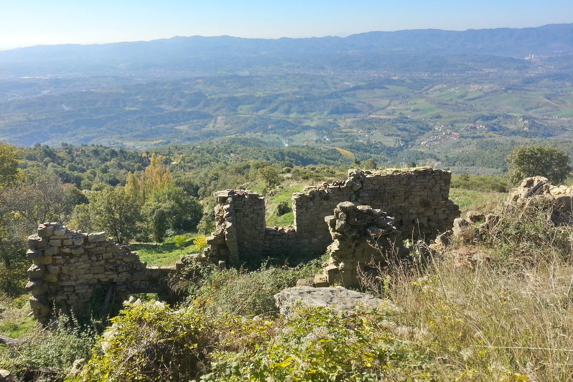
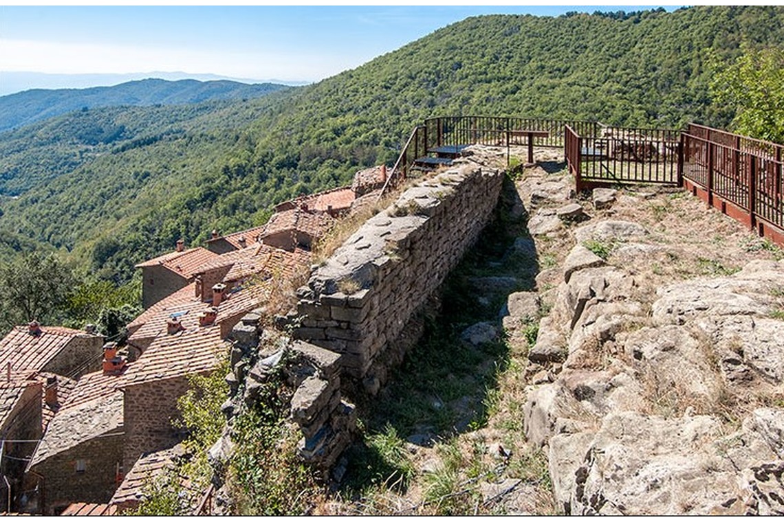
ROCCA RICCIARDA
The fortress once known as Castello della Rocca di Guicciardo was an important stronghold around the year 1000 with the function of customs between the Valdarno and the Casentino as well as being an important crossroads of exchange between the Valdarno, Casentino, Arezzo and Florence.
MEDIEVAL CASTLE
The medieval village of Loro Ciuffenna is connected to Rocca Ricciarda by a steep road. The climb ends where the castle once stood, known since 1191, of which the ruins remain on the slope towards Pratomagno. Around the 12th century, Lord Guicciardo da Loro of the Ubertini family loved to stay in the castle of Rocca Guicciarda (Rocca Ricciarda). The fortress was owned by the Guidi Counts and then by the Ricasoli family. Its remains, brought to light by the excavations conducted by the University of Florence, constitute the archaeological park of the fortress.
Culinary stop: La Rocca restaurant.
Odina - Monte Cocollo - Oliveto - Querceto - Loro Ciuffenna 4
CAI path 33
OLIVETO
Located in the territory of the castle of Cocollo, it is a small village of stone houses, very beautiful. There is a small chapel with the date 1629 carved on a stone. Nearby you can see natural caves on the hill, here called "Buche delle Fate" (means holes of Fairies) similar to what happens in other places - we recall the domus de Janas (precisely houses of fairies) in Sardinia, or the buca delle Fate on the coast between Populonia and Piombino, in front of the island of Elba; on the opposite side of the hill, under the "Salto alla lepre" in the locality of "Fonte alle Fate", a similar phenomenon occurs: whence the popular, uncontrolled rumor according to which long tunnels exist across the hill.
The visit takes 10-15 minutes.
QUERCETO
Group of houses on the slopes of Mount Cocollo, its church of Santa Maria a Querceto gathered the people of the villages located in the territory of that castle -Oliveto, Odina, Modine, until the mid-seventeenth century, when its importance began to decrease . Currently it has a facade in pietra serena which appears to have been rebuilt like the apse - and in any case it has been recently restored -, while the body of the church seems to be from a more remote era. Approximately oriented in an east-west direction, however, its façade faces east. Inside there is a panel with a painting of the Florentine school of the fifteenth century, representing the Madonna with Child in her neck. The large rectory building leans against the southern wall.
The visit takes 10-15 minutes. It is necessary to make arrangements with the parish priest of Loro Ciuffenna.
Rocca Ricciarda Trail 5
It is a 15 km ring circuit which can be covered clockwise with an uphill difference in height of 830 metres.
Overall time: 4.30 - 5.00 hours.
The excursion begins at Rocca Ricciarda - 950 m a.s.l. (the paved road coming from Loro Ciuffenna ends here).
From the small village, take the CAI path 21 in the direction of Pratomagno and start climbing through a beautiful chestnut grove up to an altitude of 1247 where you cross a large dirt road which you take to the right in a long descent - towards San Clemente in Valle (today 40 inhabitants, a century ago there were 400).
Here you find trail 21 which leads to the small medieval village of Poggio di Loro.
The path turns into a small road (a paved stretch reveals its undoubted medieval origin) which continues but not steeply uphill and leads back to Rocca Ricciarda passing through the old cemetery and back in front of the mill on the Ciuffenna stream.
Suddenly a view over the valley crossed by the Ciuffenna.
In the distance the Valdarno and even further away the Monti del Chianti.
As for signals, there are plenty of them: in addition to the classic red and white CAI ones, there are also the "patriotic" red and green ones. as well as the white-green-blue ones. Therefore - to orientate you need a 1:25.000 map and a compass or a GPS and remember to follow the classic CAI path n° 21.